 Visitors from 01/09/2009
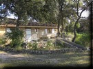
Bastidon L'HELION is a resort with a capacity of 4 persons, receiving the same environment as the Bastide L'HELION, and the same amenities (quiet, panoramic scenery, pool)
Lovers of walks, you may be filled between the sea,
hiking, fishing and many sports opportunities (golf, tennis etc.)
Aviation
activities, swimming, leisure, Cycling, Cinema, Shops, Equitation, Forest, Golf,
Beach, Fishing, Beach, Water Plan, Hiking, Restaurant, River, Historic Site,
Water Sports Sailing, Biking
By road :
From Nice :"A8 - La Provençale" out 36 "Draguignan/Le Muy/St Tropez " then approximately 12 km on the DN7 direction Les Arcs/Vidauban.
Then to take direction Les Arcs Lorgues / Salernes
then Taradeau.
From Aix : "A8 - La Provençale" direction Nice out échangeur A57 Toulon/Le Luc/Vidauban then out 13 Le Cannet des Maures/Le Luc/Vidauban.
Take the DN7 direction Vidauban-centre and after Taradeau/Lorgues by the D73.
By train :
Station SNCF-TGV "Les Arcs-Draguignan" (6km).
By plane :
Aéroports internationaux de Toulon-Hyères www.toulon-hyeres.aeroport.fr (71 km) et de Nice Côte d'Azur www.nice.aeroport.fr (81km)
Distances :Paris : 850 km, Marseille : 124 km, Toulouse : 480 km, Nice : 88 km, Lille : 1077 km, Nantes : 1045 km, Grenoble : 271 km, Clermont-Ferrand : 552 km
 Small Village Center Var-renowned for its
vineyards, Taradeau is dominated by a tower and its chapel, ruins dating from
the Gallo-Roman times when the village was serviced by the Aurelian Way
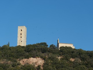
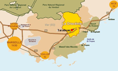
Close to the major routes of communication as the A8 motorway or the 7 national Taradeau is situated between sea (Fréjus Saint Raphaël, Ste Maxime, St Tropez...) and mountain (the Verdon Gorges, Lac de Ste-Croix).
Main attractions nearby :
Lac de Sainte Croix / Gorges du Verdon : 45km
Abbaye du Thoronet : 15 km
Monaco : 105km
Saint Tropez : 25km
Toulon et sa rade : 65km
Fréjus - Saint Raphaël : 30km
Giens : 75km
Lac de Saint Cassien : 45km.
 |
 |
 |
 |
 |
 |
 |
distance TARADEAU aux autres communes du Var :
VIDAUBAN : 2,76km - LES ARCS : 4,14km - LORGUES : 6,94km - TRANS EN PROVENCE : 7,49km - FLAYOSC : 9,33km - LA MOTTE : 9,63km - DRAGUIGNAN : 9,97km - LE MUY : 11,24km - FIGANIERES : 14,01km - LA GARDE FREINET : 15,60km - ENTRECASTEAUX : 16,51km - ROQUEBRUNE SUR ARGENS : 17,18km - CALLAS : 17,46km - MONTFERRAT : 17,95km - TOURTOUR : 18,35km - VILLECROZE : 18,80km - CLAVIERS : 19,76km - SALERNES : 19,89km - CARCES : 20,20km - BARGEMON : 20,82km - GRIMAUD : 21,51km - STE MAXIME : 23,15km - BESSE SUR ISSOLE : 23,34km - BAGNOLS EN FORET : 23,55km - COGOLIN : 23,59km - COTIGNAC : 23,63km - SILLANS LA CASCADE : 23,77km - MONTFORT SUR ARGENS : 25,02km - FREJUS : 25,09km - AUPS : 25,49km - LES ISSAMBRES : 25,70km - CARNOULES : 25,79km - SEILLANS : 26,42km - ST TROPEZ : 26,46km - ST RAPHAEL : 27,48km - CORRENS : 28,37km - FAYENCE : 28,41km - LE VAL : 28,79km - LA CROIX VALMER : 29,44km - BRIGNOLES : 29,56km - RAMATUELLE : 30,00km - PUGET VILLE : 30,03km - CAVALAIRE SUR MER : 31,60km - LES ADRETS DE L ESTEREL : 31,67km - LA CELLE : 31,92km - CALLIAN : 32,10km - REGUSSE : 32,29km - CANADEL : 32,60km - MONTAUROUX : 32,72km - RAYOL CANADEL SUR MER : 33,02km - TRIGANCE : 34,33km - PIERREFEU DU VAR : 34,41km - BORMES LES MIMOSAS : 34,46km - LE LAVANDOU : 35,13km - MONS : 35,16km - AGAY : 35,31km - BARJOLS : 36,06km - ST CEZAIRE SUR SIAGNE : 36,56km - LA PALUD SUR VERDON : 37,11km - NEOULES : 37,12km - CUERS : 37,47km - BAUDUEN : 37,49km - BRAS : 38,12km - LA LONDE LES MAURES : 38,20km - AIGUINES : 38,83km - TANNERON : 39,17km - LES SALLES SUR VERDON : 39,87km
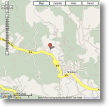
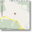
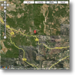
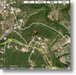
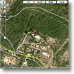
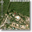
position : latitude : 43.46120527774265
longitude : 6.418440341949463
